Category: Travel

  • What is Run-cations? Why marathon holidays are the new travel trend

    What is Run-cations? Why marathon holidays are the new travel trend

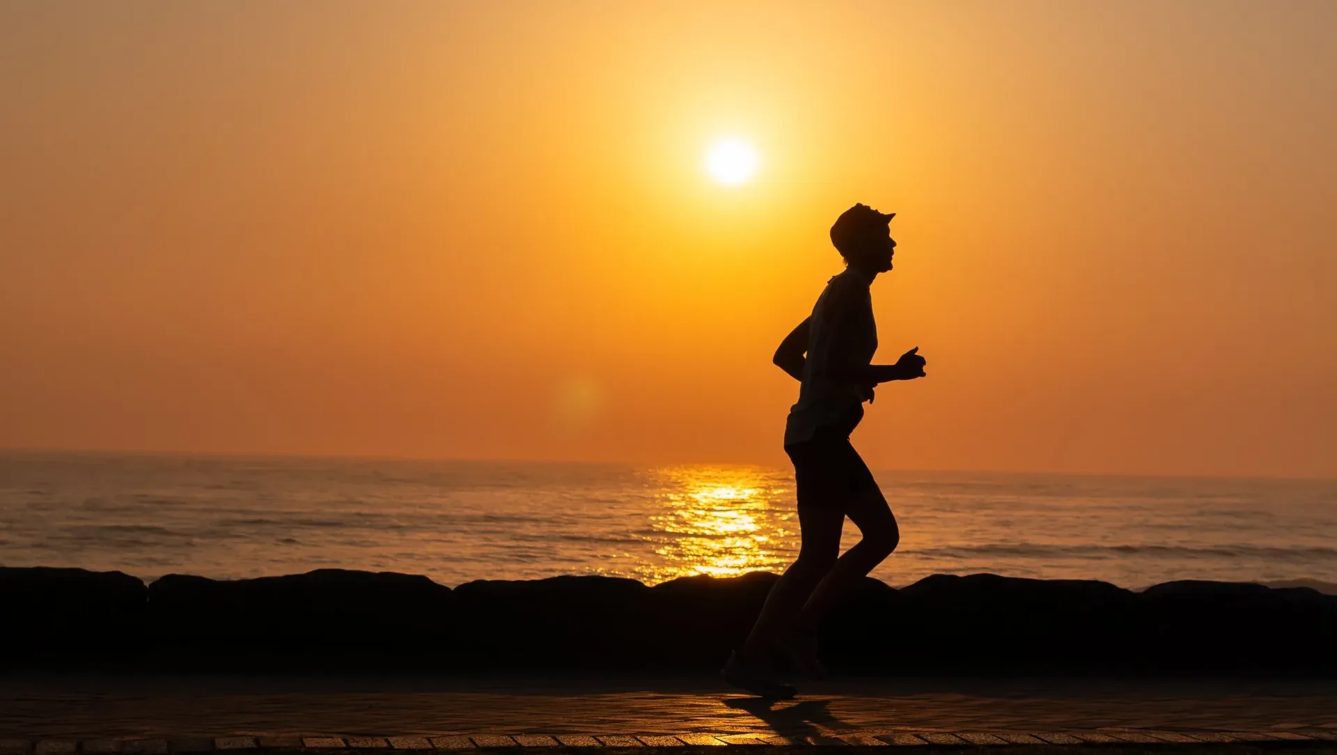
    What if your next holiday was planned not around a beach, a resort or a sightseeing list, but around a marathon? That is the idea behind run-cations, a growing travel trend that puts a running event at the heart of the itinerary.

    Instead of simply signing up for a race during an existing holiday, travellers are choosing the marathon first and then building the rest of their trip around it. Flights, hotels, recovery days, pre-race meals and sightseeing can all become part of the plan.

    Also Read | Water-based places in India: 4 stunning destinations to see

    For runners, it turns a race into more than a 42.195-km challenge. For destinations, it offers another way to experience a city, one that combines fitness, food, culture and exploration.

    What exactly is a run-cation?

    A run-cation combines running with vacationing. The race is the primary reason for the trip, while the destination becomes part of the overall experience.

    A typical run-cation could involve arriving a few days before race day, allowing time to settle in and acclimatise, followed by the marathon and a slower-paced holiday afterwards.

    From Tokyo to New York, travellers are planning holidays around marathons, turning race weekends into full-fledged city breaks.
    From Tokyo to New York, travellers are planning holidays around marathons, turning race weekends into full-fledged city breaks. / Pexels

    Instead of rushing through a checklist of tourist attractions, travellers can use the trip to explore neighbourhoods, sample local cuisine and experience the city at a more relaxed pace once the race is over.

    The concept also taps into the wider shift towards experience-led travel, where activities and personal milestones increasingly shape holiday plans.

    Why are travellers choosing marathon holidays?

    The growing overlap between fitness and travel is one of the key factors behind the trend.

    For many runners, a marathon provides a clear goal to work towards. Training for a race can begin months before the holiday, giving the trip a sense of purpose beyond simply taking a break.

    The new travel itinerary? Run, recover, explore and repeat.
    The new travel itinerary? Run, recover, explore and repeat. / Pexels

    There is also the community aspect. Major marathons bring together runners from different countries and backgrounds, creating an experience that extends beyond the race itself.

    And once the finish line is crossed, the holiday does not have to end. Travellers can spend the following days recovering while exploring the destination, turning a race weekend into a longer city break.

    Which destinations are popular for run-cations?

    Several major marathon destinations also happen to be cities that attract international tourists throughout the year.

    1. Tokyo

    The Tokyo Marathon combines a major international race with the chance to explore one of Asia’s most distinctive cities. Runners can extend their trip with visits to temples, neighbourhoods, food markets, shopping districts and pop-culture hotspots.

    1. London

    The London Marathon is a bucket-list event for many runners. The city’s museums, historic landmarks, markets and neighbourhoods make it easy to turn race weekend into a longer holiday.

    1. Berlin

    Berlin offers runners the appeal of a major city marathon alongside a destination known for its history, museums, food and nightlife. The result is a natural combination of race and city break.
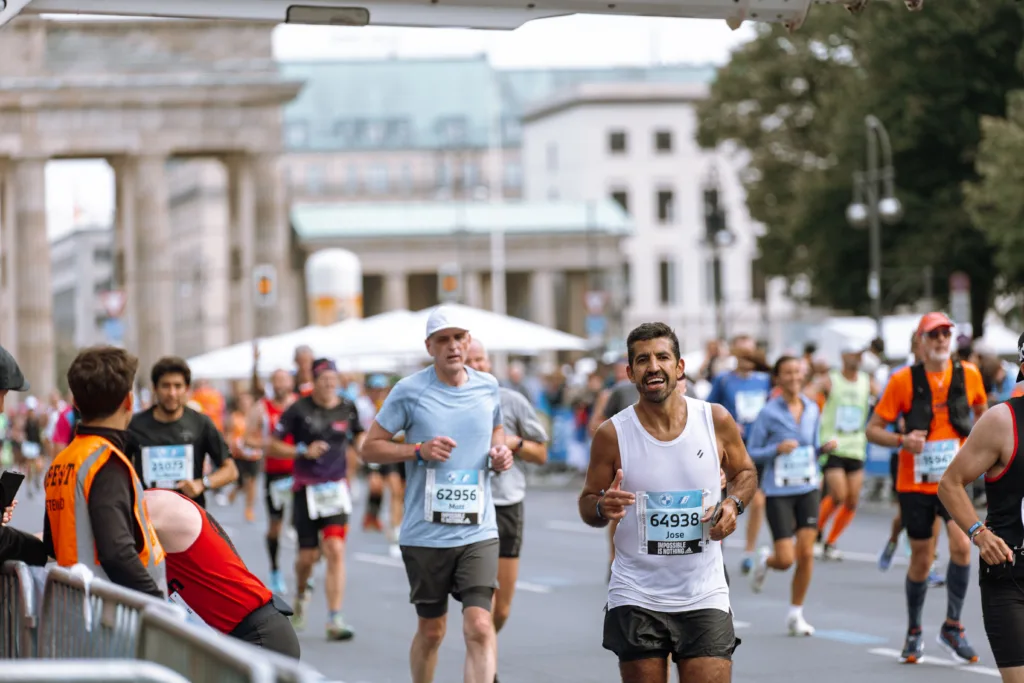
    Run a marathon, explore a city, repeat: the rise of ‘run-cations’.
    Run a marathon, explore a city, repeat: the rise of ‘run-cations’. / Pexels
    1. New York

    The New York City Marathon offers a particularly immersive way to experience the city, with the race route passing through several of its iconic boroughs. Travellers can then stay on to explore the city beyond race day.

    1. Sydney

    Sydney has gained further prominence among marathon travellers after joining the Abbott World Marathon Majors. Its beaches, harbour and urban attractions add a conventional holiday experience to the race itinerary.

    What makes run-cations different from regular race trips?

    It is all about the planning. A normal vacation might include a race as part of the activities but a run-cation includes a race from the start.

    This can affect everything from where you go, when you travel to where you stay, how many meals you have and how many recovery days you plan to take after the event.

    Also Read | Do you know why airlines really ask you to put your phone on airplane mode?

    For other travelers, it can be about seeing a city in a different light. Running the city allows you to see it in a way which traditional travel cannot, as well as giving you the time around the event to explore it.

    With the continued blend between fitness, community and experience-based travel, the running shoes are becoming a key part of the modern day traveler’s pack – right next to their passport and camera.

  • Do you know why airlines really ask you to put your phone on airplane mode?

    Do you know why airlines really ask you to put your phone on airplane mode?

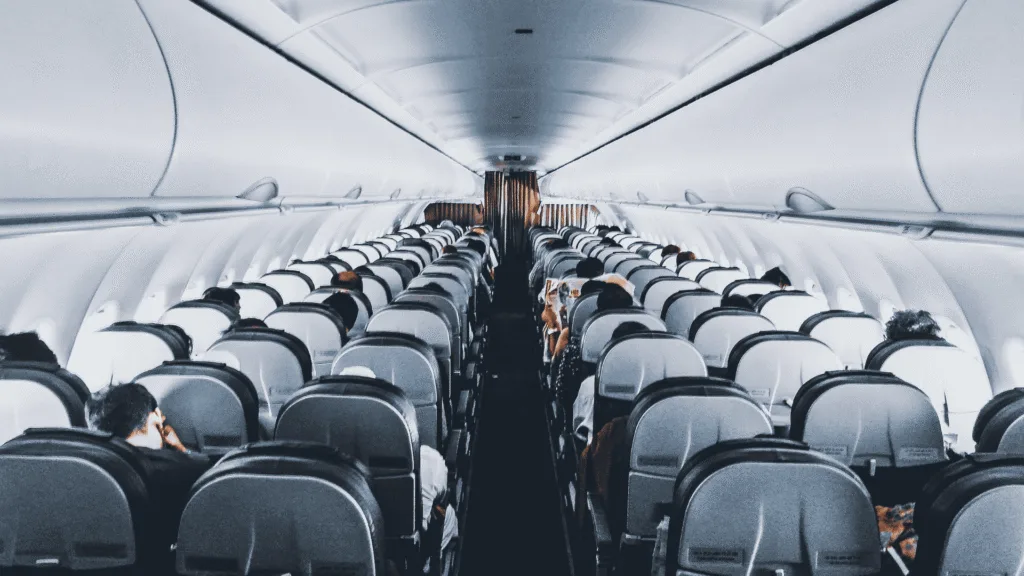
    Switching your phone to Airplane Mode during a flight may feel like a routine instruction, but there are practical reasons behind the rule. It is not because an active smartphone is expected to suddenly cause an aircraft engine to fail. Instead, the restriction is linked to radio transmissions, communication systems and the way cellular networks operate when phones are airborne.

    How does cellular interference affect flights?

    A smartphone constantly searches for available cellular networks when its mobile connection is switched on. At cruising altitude, the phone may attempt to connect to ground-based towers as the aircraft moves rapidly across different areas. Multiple devices doing this at the same time can create unwanted radio-frequency activity.

    airlines really ask you to put your phone on airplane mode
    Your phone’s signal matters even at 35,000 feet | AI Generated

    Aviation systems are designed with safeguards, but airlines still require passengers to minimise unnecessary transmissions during a flight.

    Also Read | Water-based places in India: 4 stunning destinations to see

    Can mobile phones cause buzzing in pilot headsets?

    Cellular devices can produce electromagnetic interference with nearby audio equipment. This could even lead to buzzing or static noises being produced by speakers and headphones. Putting cell phones on airplane mode is just one way of preventing any potential sources of interference within the plane.

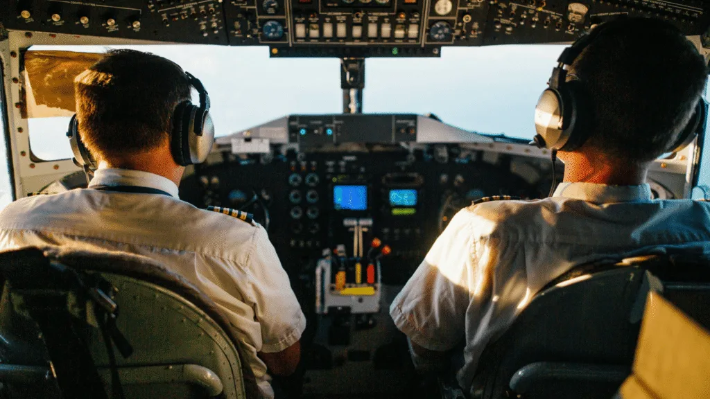
    plane (1) (1)
    Flight safety goes beyond switching off your phone | AI Generated

    Communications between pilots and air traffic control towers are extremely important especially during takeoff and landing.

    What about navigation and cockpit equipment?

    Modern aircraft contain highly protected communication and navigation systems. Airplane Mode reduces the amount of radio activity coming from passengers’ devices, helping maintain a controlled electronic environment inside the aircraft.

    This is one reason airlines continue to include the setting in their standard passenger safety instructions.

    Also Read | What makes Mount Kailash so sacred? A detailed guide for the Himalayan pilgrimage

    Why does 5G raise separate concerns?

    5G has also brought additional attention to aviation because some 5G C-band frequencies are close to frequencies used by aircraft radar altimeters. These are key sources of altitude data especially when approaching the airport and landing.

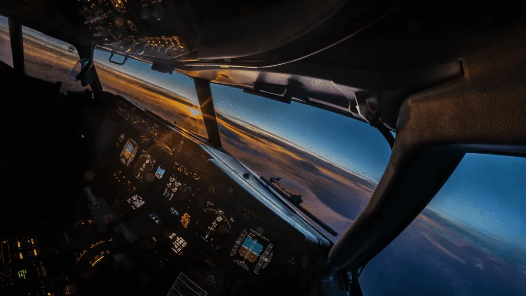
    plane (2) (1)
    The real reason airlines insist on airplane mode | AI Generated

    Some interventions have been put in place by the aviation industry and the regulatory authorities to help mitigate the effects of interference between 5G technology and aircrafts’ system.

    Why Airplane Mode is needed even now

    Therefore, when cabin crew asks passengers to put their phones in Airplane Mode, it means that the need is to prevent interference with electronics and avoid unnecessary wireless communication on board an aircraft.

  • Water-based places in India: 4 stunning destinations to see

    Water-based places in India: 4 stunning destinations to see

    India’s diverse geography is home to communities whose lives are closely connected to lakes, rivers and tidal waterways. In these places, water is not simply part of the landscape, it can determine how people travel, work, grow food and build their homes.

    From the floating phumdis of Manipur to the river islands of Assam, thWhether it’s the floating phumdis of Manipur or the river islands of Assam, such destinations give one a look into the lifestyles of people living in association with water bodies.

    Also Read | Darjeeling to Bhutan: The autumn escape that became my favourite journey

    Loktak Lake, Manipur

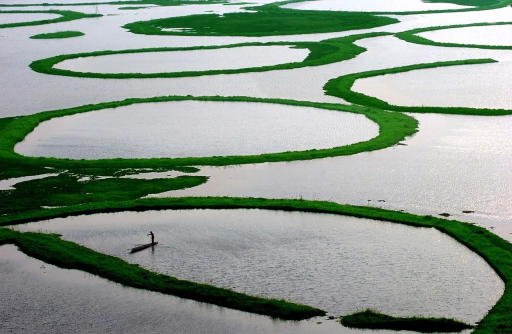
    Manipuri Loktak Lake is famed for its characteristic floating mounds of vegetation, soil and organic debris called phumdis.

    The inhabitants near the lake have been depending on the lake for their living through fishing in it. Boats play an integral part in daily lives, along with some huts and other constructions scattered about in the lake.

    Loktak Lake, Manipur
    Loktak Lake, Manipur / Wikipedia

    Loktak is also the site of Keibul Lamjao National Park which is the world’s only floating national park. The national park is situated within the phumdis of the lake and it houses the sangai or Manipur brow-antlered deer which is an endangered species.

    The combination of floating land, fishing and unique wildlife makes Loktak one of India’s most distinctive water landscapes.

    Dal Lake, Srinagar

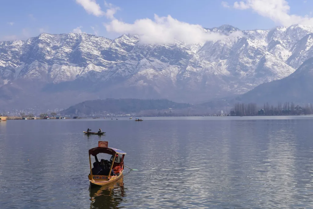
    Srinagar’s Dal Lake is closely associated with its houseboats and colourful shikaras, but the lake also supports livelihoods that go beyond tourism.

    Peaceful view of Dal Lake in Srinagar surrounded by snowcapped Himalayas, featuring traditional boats.
    Dal Lake in Srinagar surrounded by snowcapped Himalayas / Pexels

    Floating gardens are used to grow vegetables, while boats transport produce across the water and towards markets. The lake’s early-morning vegetable market is among its best-known attractions.

    For communities living and working around Dal Lake, fishing, water-based cultivation, transport and tourism have become closely intertwined with everyday life.

    Majuli, Assam

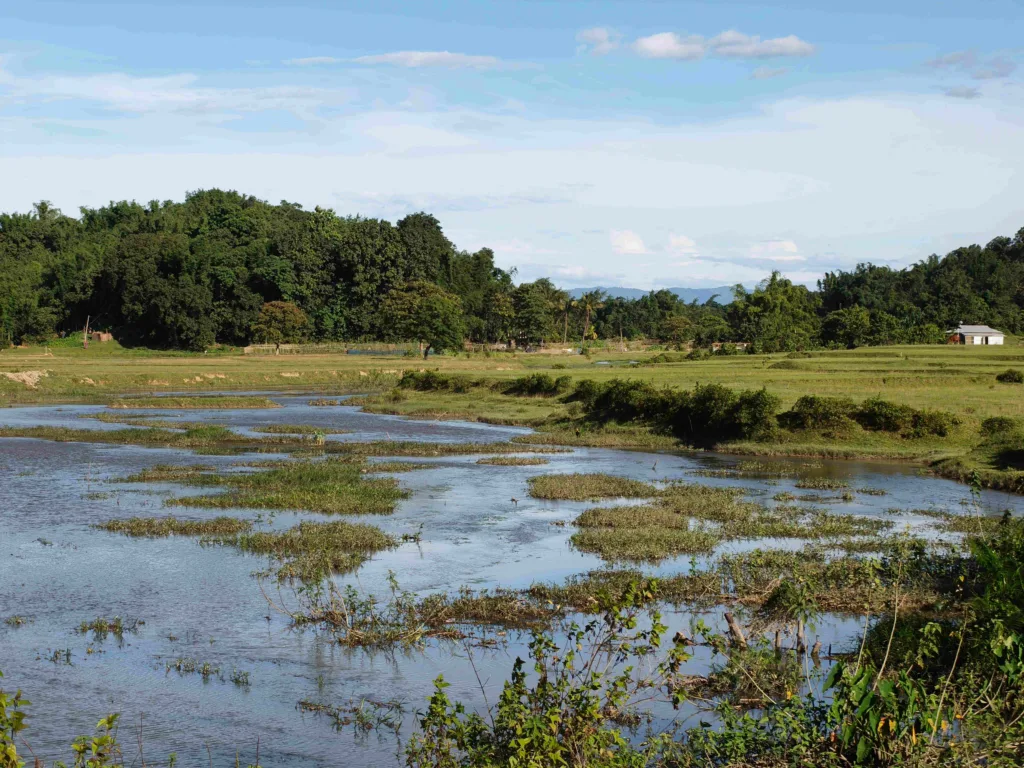
    Majuli is a river island in Assam whose geography is shaped by the Brahmaputra.

    Life on the island has long involved adapting to seasonal flooding, erosion and changes in the river’s channels. Agriculture, fishing and boat transport remain important to many communities.

    Majuli, Assam water body
    Majuli, Assam / Pexels

    Majuli is also known for its rich Assamese Vaishnavite heritage. Its satras, traditional performing arts, music and mask-making traditions form an important part of the island’s cultural identity.

    The Brahmaputra therefore shapes not only Majuli’s landscape but also the way its communities live and work.

    Sundarbans, West Bengal

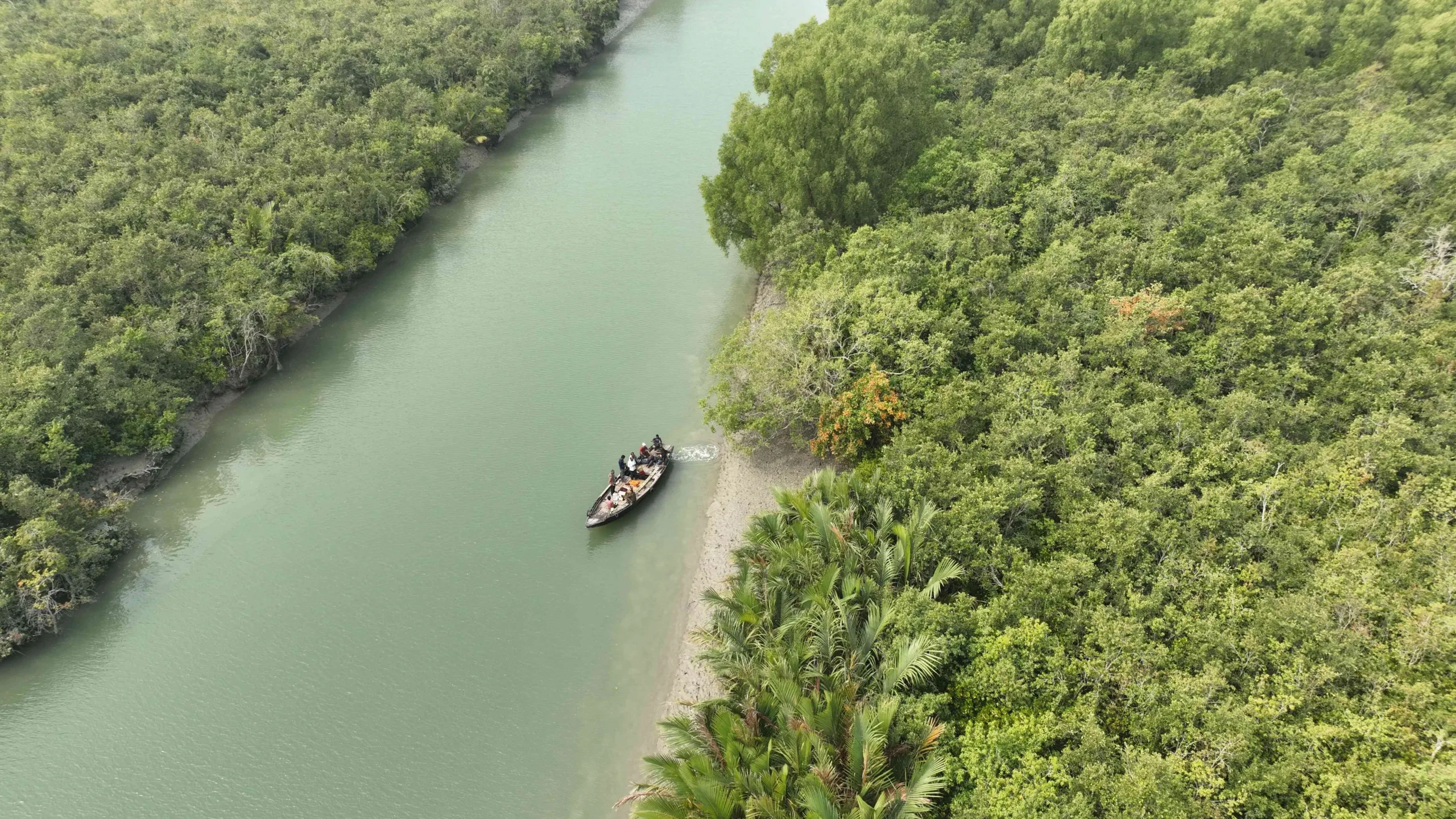
    The Sundarbans is one of the world’s largest mangrove delta systems, where rivers, creeks and tidal channels dominate the landscape.

    Unlike a floating settlement, the Sundarbans represents a different form of life shaped by water. Villages exist in an environment where tides, erosion and changing water levels can directly affect homes and livelihoods.

    sundarbans, west bengal
    Sundarbans, West Bengal / Pexels

    Waterways are another key way of transportation in several regions within the area. Fishing, crab catching, honey collecting and agricultural activities are all common here.

    Also Read | What makes Mount Kailash so sacred? A detailed guide for the Himalayan pilgrimage

    The area also poses certain environmental difficulties that need to be taken into account. Cyclones, floods, soil erosion, and saltwater intrusion may all impact human settlements and economic activity, thus adaptation becomes one of the necessary aspects of life.

    Water is not only a background

    In Loktak, Dal Lake, Majuli and Sundarbans, water may serve differently. It may be a source of food, a means of transportation, a place to grow crops or a factor that constantly changes the area’s shape.

    These areas together give us an example of how Indian communities have created their own lifestyles in water-related areas.

  • What makes Mount Kailash so sacred? A detailed guide for the Himalayan pilgrimage

    What makes Mount Kailash so sacred? A detailed guide for the Himalayan pilgrimage

    The devastating floods and landslides near the Nepal-Tibet border have brought the Kailash Mansarovar Yatra into sharp focus. Indian pilgrims travelling to or from the sacred site have been among those affected, with hundreds reported missing or unaccounted for and several others stranded on the Tibetan side after roads and border crossings were disrupted.

    The disaster has also drawn attention to one of the most demanding religious journeys in the Himalayas, centred on Mount Kailash and Mansarovar Lake.

    Why is Mount Kailash sacred?

    For Hindus, Mount Kailash is believed to be the abode of Lord Shiva and Goddess Parvati. The mountain is closely linked with Shiva’s meditation and spiritual transcendence, while the pilgrimage is traditionally associated with the pursuit of moksha, or salvation. Hindu tradition also holds that Ravan sang the Shiva Tandav Stotram here to please Lord Shiva.

    Also Read | Did you know there’s a secret trail between Kedarnath and Badrinath? Discover the lost Himalayan path of the gods

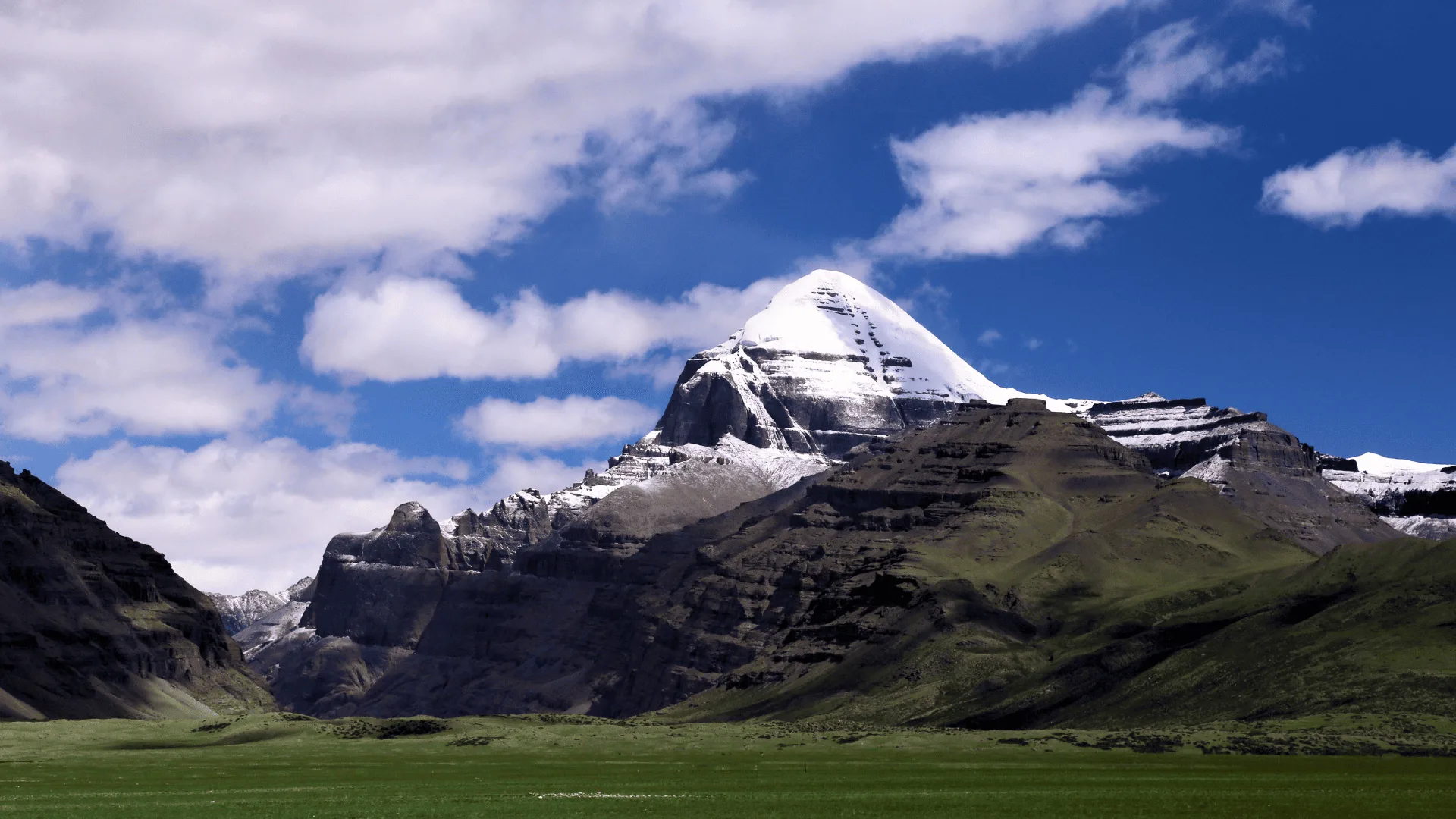
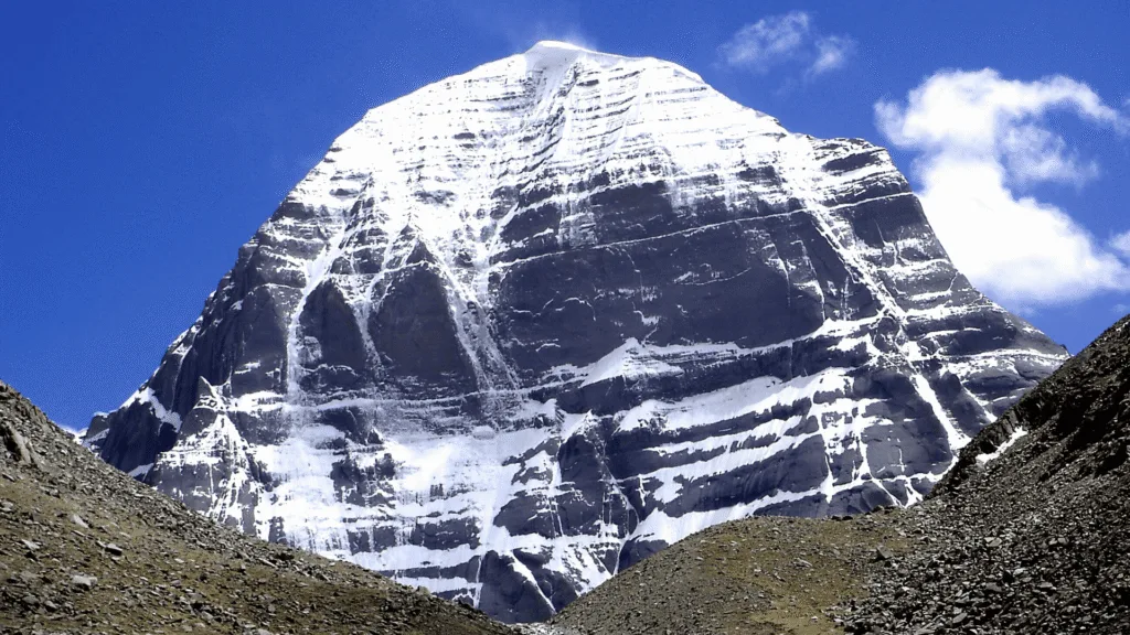
    Mount Kailash remains sacred across Hindu, Buddhist and Jain traditions.
    Mount Kailash remains sacred across Hindu, Buddhist and Jain traditions | Wikipedia

    Kailash is revered beyond Hinduism too. In Buddhism, it is associated with Mount Meru, the cosmic mountain. Jain traditions connect the region with Rishabhadeva, the first Tirthankara, and his liberation. The Tibetan Bon tradition, which predates Buddhism in Tibet, also considers Mount Kailash and its surrounding landscape sacred.

    Mansarovar lake and its spiritual importance

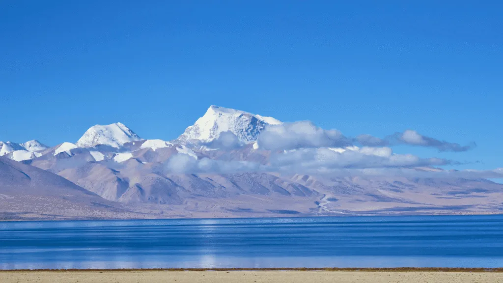
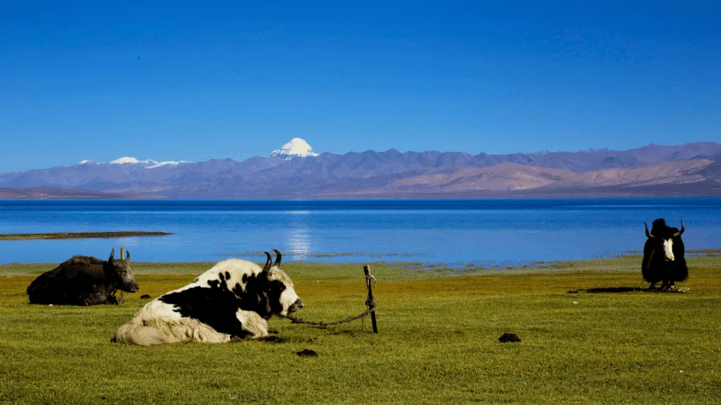
    Located at around 4,557 metres above sea level, Mansarovar is among the world’s highest freshwater lakes. Its Sanskrit name, Manas-sarovar, is traditionally linked to manas, meaning mind, and sarovar, meaning lake.

    Mansarovar Lake holds deep spiritual significance for pilgrims.
    Mansarovar Lake holds deep spiritual significance for pilgrims | Wikipedia

    In Hindu belief, the lake is associated with Brahma. For pilgrims, bathing in or drinking its water carries deep religious significance. The region also lies near the headwaters of the Indus, Sutlej, Brahmaputra and Karnali river systems.

    What is the Kailash Parikrama?

    The traditional journey through Tibet includes places such as Saga and Darchen, the settlement from where pilgrims begin the 52-km Kailash parikrama, or kora. Depending on the route and arrangements, about 10 km may be covered by vehicle, leaving roughly 42 km on foot.

    Also Read | Darjeeling to Bhutan: The autumn escape that became my favourite journey

    The trek is generally completed over three days. The most difficult section is the Dolma La Pass, at about 5,630 metres. From there, pilgrims descend towards Zuthulphuk before returning to Darchen.

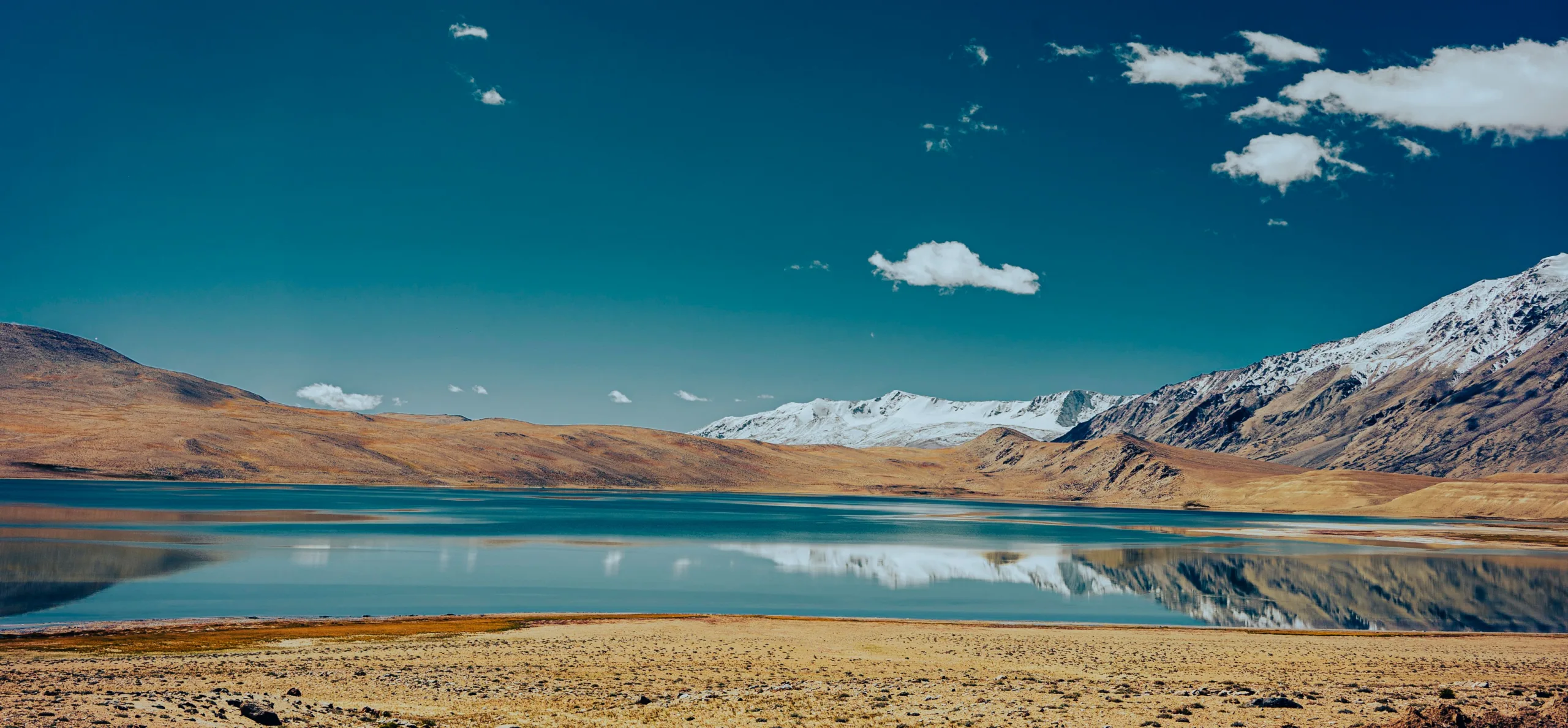
    Mansarovar lake
    The 52-km Kailash parikrama tests pilgrims at extreme altitude | Wikipedia

    For millions, the Kailash Mansarovar Yatra remains a journey shaped by faith, difficult terrain and centuries-old religious traditions.

  • Darjeeling to Bhutan: The autumn escape that became my favourite journey

    Darjeeling to Bhutan: The autumn escape that became my favourite journey

    Sometimes, the best journeys begin with an escape rather than a plan.

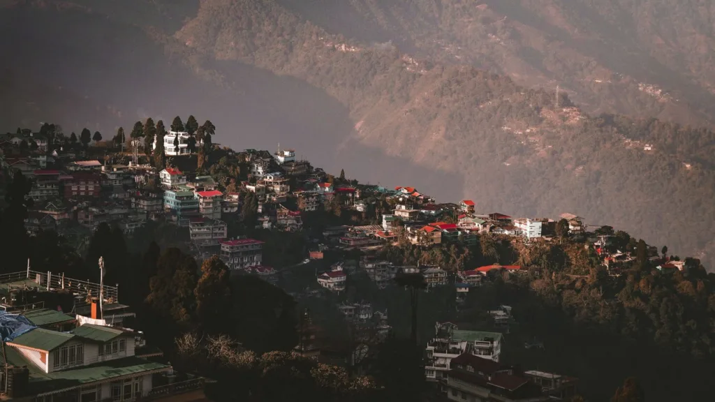
    Three years ago, during the Durga Puja holidays, I travelled to Darjeeling, a place I have visited almost every year for decades. But this time felt different. It had been nearly 15 years since I had experienced the Queen of the Hills during Puja, and the overwhelming crowds made me fear that my affection for the town might slowly fade.

    So I did something spontaneous. I decided to travel abroad.

    That “foreign country” was Bhutan.

    For me, travelling abroad has never been about ticking off distant countries or boarding long-haul flights. I still believe I haven’t fully explored India itself, let alone North Bengal. A lifetime isn’t enough to uncover every hidden corner of this region. For the last 46 years, I have happily lived with an incurable case of wanderlust, and perhaps that lifelong obsession with travel has kept my mind healthier than any medicine ever could.

    Crossing into another world

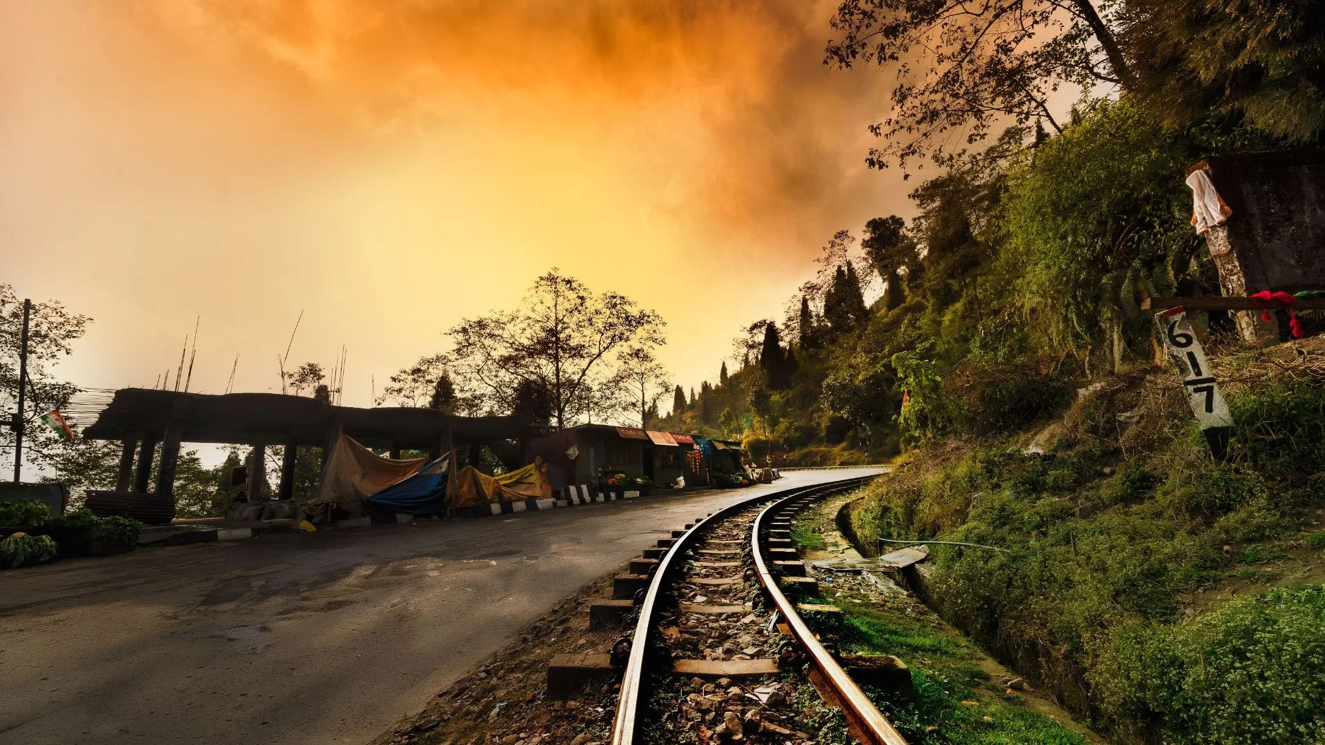
    Leaving Darjeeling behind, I drove towards Jaigaon, the bustling Indian town on the Indo-Bhutan border. As the hills slowly dissolved into the plains, the scenery transformed into endless tea gardens, dense forests and emerald-green fields.

    Discover the best of Bhutan, from majestic mountains and ancient monasteries to serene valleys and charming towns
    Discover the best of Bhutan, from majestic mountains and ancient monasteries to serene valleys and charming towns | Pexels

    It was mid-October.

    Under a brilliant blue sky scattered with cotton-white clouds, I felt less like a tourist and more like a humble traveller approaching the kingdom of a benevolent king.

    Nearly 200 kilometres later, the magnificent Dragon Gate appeared before me. Beyond it lay Phuentsholing—the welcoming gateway to Bhutan.

    Also Read | When is the best time to visit Kalimpong? Here’s a season-by-season travel guide

    The change was immediate.

    Phuentsholing felt remarkably clean, peaceful and organised. Since travellers need an entry permit to venture beyond the town, most visitors spend a night there, and so did we. Our comfortable hotel cost around ₹2,500. We could have stayed more cheaply in Jaigaon, but spending the first night inside Bhutan felt like the perfect beginning.

    That afternoon we explored the Crocodile Park, wandered through a fascinating cave park and ended the day at a beautiful monastery perched nearly 1,500 feet above the town. Watching Jaigaon merge into the vast Dooars plains from that height remains one of my favourite memories.

    From majestic Himalayas to serene monasteries, explore the beauty and charm of Bhutan on an unforgettable travel journey
    From majestic Himalayas to serene monasteries, explore the beauty and charm of Bhutan on an unforgettable travel journey | Pexels

    Eight hours to Thimphu

    The next morning we set off for Thimphu.

    The distance from Phuentsholing is only 172 kilometres, but Bhutan teaches you early that mountain roads measure journeys differently. Eight hours passed as every bend revealed another masterpiece, blue mountains fading into the horizon, mist-covered villages and valleys that seemed untouched by time.

    Lunch came at a restaurant that felt suspended among the clouds. Sitting there, I couldn’t shake the feeling that we had briefly left the earth behind.

    At nearly 8,000 feet above sea level, Thimphu strikes a rare balance between tradition and progress. Under King Jigme Khesar Namgyel Wangchuck’s leadership, the capital has managed to modernise without losing its cultural soul.

    The city offers plenty to explore, the Royal Palace, the towering Buddha Dordenma overlooking the valley, the National Heritage Museum and the lively Clock Tower Square. Flowing quietly through it all is the Wang Chhu River, known as the Raidak River after crossing into India.

    Punakha: Where history lives on

    Our journey then took us to Punakha, Bhutan’s ancient capital until 1955.

    Standing at the meeting point of the Mo Chhu and Pho Chhu rivers, Punakha Dzong is far more than a beautiful fortress. It was here that Ugyen Wangchuck was crowned Bhutan’s first king in 1907.

    Surrounded by suspension bridges, waterfalls, forests and rolling mountains, Punakha carries an almost eternal springtime charm. It is the kind of place where history never feels trapped inside museum walls—it simply lives around you.

    Paro and the monastery that defies gravity

    About 55 kilometres from Thimphu lies Paro, another valley that feels almost unreal.

    The town is home to Bhutan’s only international airport, widely regarded as one of the world’s most challenging airports because of its short runway and towering Himalayan peaks. Only specially trained pilots are permitted to land there.

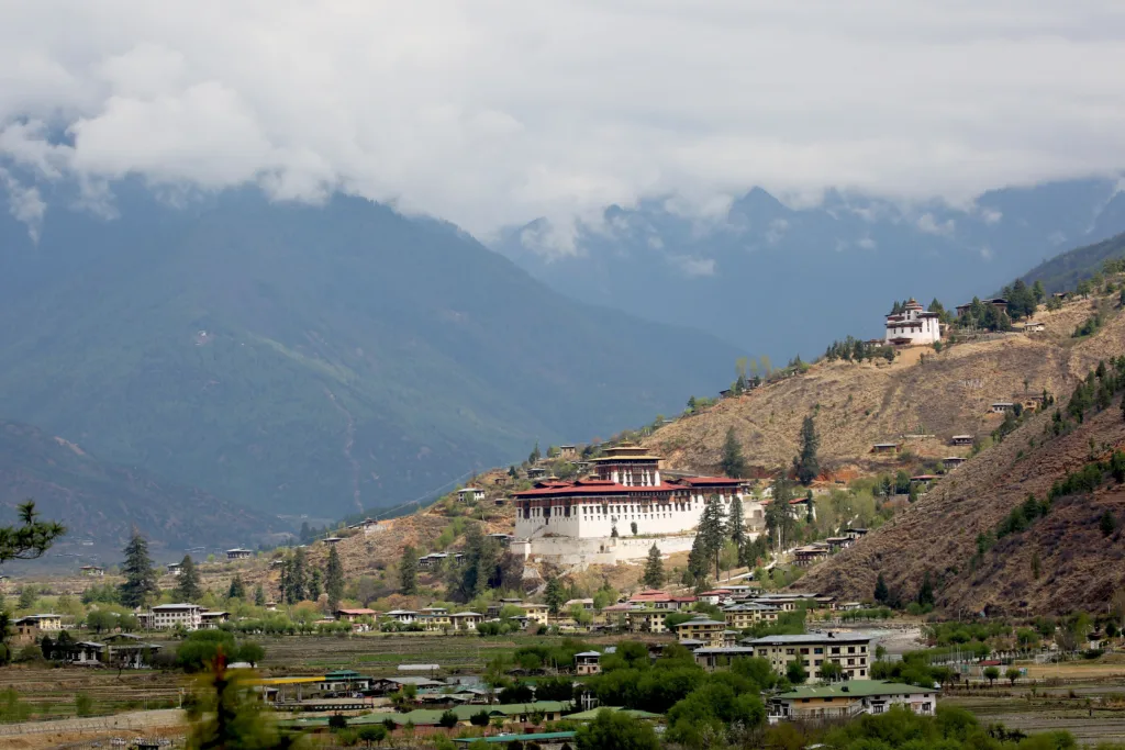
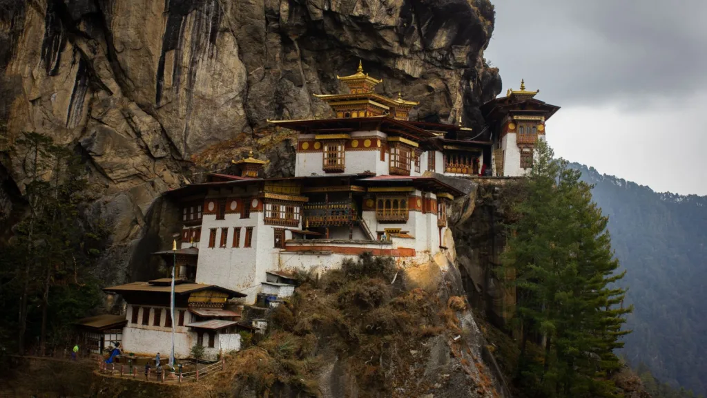
    Paro’s Rinpung Dzong is an architectural masterpiece, but nothing prepares you for Tiger’s Nest Monastery.

    Clinging dramatically to a steep cliff, Taktsang can only be reached by hiking or horseback. It is one of Bhutan’s holiest sites, and standing there, suspended between rock and sky, I understood why it has become the country’s most enduring symbol.

    Explore Bhutan’s breathtaking landscapes, peaceful monasteries and scenic mountain roads on an unforgettable journey
    Explore Bhutan’s breathtaking landscapes, peaceful monasteries and scenic mountain roads on an unforgettable journey | pexels

    The magic of Bhutan’s mountain passes

    Some of Bhutan’s most unforgettable moments happen on its roads.

    Dochula Pass, sitting at around 10,300 feet, is breathtaking throughout the year. Winter blankets it in snow, while drifting clouds dominate the remaining seasons. The 108 memorial chortens standing against snow-capped Himalayan peaks create a view that lingers long after you’ve left.

    Also Read | Sawan 2026: Planning a Jyotirlinga Yatra? Here’s a travel guide for you

    Then came Chele La Pass.

    At over 13,000 feet above sea level, the journey itself becomes the adventure. Snow-covered trees, frozen waterfalls and icy mountain winds welcomed us at every turn.

    Even the warm clothes I had packed for Darjeeling suddenly felt inadequate.

    The cold forced us to leave sooner than we wanted, but my heart wasn’t quite ready to descend.

    Is Bhutan expensive?

    Bhutan accommodates every kind of traveller.

    Hotels begin at around ₹1,500 a night, while properties priced above ₹2,000 usually offer excellent comfort and hospitality. Food is comparatively expensive, but the country’s cleanliness, peaceful atmosphere and warm hospitality make every rupee feel worthwhile.

    Discover why Bhutan is a dream destination with stunning mountains, ancient dzongs, peaceful monasteries and scenic valleys
    Discover why Bhutan is a dream destination with stunning mountains, ancient dzongs, peaceful monasteries and scenic valleys | Pexels

    How many days are enough for Bhutan?

    In my experience, seven days are the minimum needed to appreciate Bhutan properly.

    But if you truly want to understand its monasteries, mountain villages, rivers and gentle people, even a month feels surprisingly short.

    Bhutan isn’t simply another country to visit. It is a place where happiness seems measured less by wealth than by smiles, serenity and simplicity. Every journey there leaves me with more than photographs, it leaves me with a quieter mind and a gentler heart.

    Perhaps that is Bhutan’s greatest gift. You arrive hoping to discover a beautiful country, and somewhere along the way, you end up rediscovering yourself.

    Author: Parthamoy Chatterjee

  • When is the best time to visit Kalimpong? Here’s a season-by-season travel guide

    When is the best time to visit Kalimpong? Here’s a season-by-season travel guide

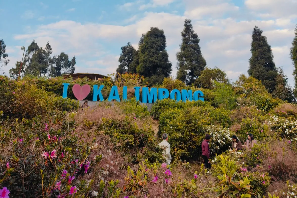
    Perched in the foothills of the Himalayas, Kalimpong offers a different reason to visit with every changing season. Spring brings rhododendron blooms and adventure activities, autumn paints the surrounding forests in warmer shades, while winter offers some of the clearest views of the snow-covered Himalayas.

    And then there is the food. From jhol momos and thukpa to sel roti and Nepali thalis, Kalimpong’s culinary appeal doesn’t disappear when the weather changes.

    Thus, what would be the best time to visit Kalimpong? Well, according to the season-wise travel guide published in the magazine of Conde Nast Traveller India, the widest period suitable for travelling falls between October and February.

    ALSO READ| Did you know there’s a secret trail between Kedarnath and Badrinath? Discover the lost Himalayan path of the gods

    When is the best time to visit Kalimpong?

    October to February is the recommended period if your priority is comfortable weather, autumn landscapes and clear Himalayan views.

    Sal forests surrounding Sikkim will be decked up with autumn colours during October and November. December through February are famous for clear skies and better views of Mount Kanchenjunga.

    On the other hand, for those who like adventure sports and would like to enjoy nature’s beauty, March and April may turn out to be more favourable seasons. Wildflowers and rhododendron bloom in this period.

    The monsoon months can be less convenient for travel, with the source noting muggy conditions, difficult roads and the possibility of flash-flood warnings.

    What can you see in Kalimpong during spring?

    If flowers are the reason for your trip, late February to April is the season to consider.

    The forests around Lava and Neora Valley National Park come alive with rhododendrons, with March and April generally considered a good period to see the blooms. Flowering can vary depending on altitude and weather conditions each year.

    Spring also works well for hiking, birdwatching and scenic drives, while the surrounding hills offer opportunities for adventure activities.

    When is the best time to see Kanchenjunga?

    For Himalayan views, October to February is the strongest window.

    Post-monsoon skies are generally clearer and humidity is lower. Early mornings are particularly favourable because clouds can gather around the mountains later in the day.

    Deolo Hills and Durpin Dara Hill are among the viewpoints highlighted in the source. Travellers willing to venture farther can also explore Ramdhura, Lava and Rishop for mountain views.

    ALSO READ| Sawan 2026: Planning a Jyotirlinga Yatra? Here’s a travel guide for you

    What about Kalimpong’s food scene?

    You don’t necessarily need perfect weather to visit Kalimpong if food is your priority.

    The town’s culinary landscape draws from Lepcha, Nepali, Tibetan and Bhutanese influences, with dishes ranging from jhol momos and tingmo to thukpa, kewa datshi, pork momos and Nepali thalis.

    The local Haat Bazaar, held on Wednesdays and Saturdays, is another attraction for food lovers, with local produce, pickled bamboo, millet-based ferments and street food.

    How many days do you need in Kalimpong?

    Three days can be enough to explore Kalimpong itself, according to the source.

    However, travellers who want to explore surrounding tea estates and natural attractions at a slower pace can plan for a week or more.

    The town can also be combined with a Darjeeling trip. Kalimpong is roughly a two-hour drive from Darjeeling, while Bagdogra International Airport is around 2.5 hours away by road, according to the source.

    Kalimpong weather by season
    March-April: 13°C-25°C
    May-October: 17°C-30°C
    November-February: 5°C-21°C

    ALSO READ| Pancha Kedar–Part 1: Why did Lord Shiva hide from the Pandavas?

    Ultimately, the best time to visit Kalimpong depends on what you want from the hills. Choose spring for rhododendrons and adventure, autumn for walks and changing forests, and winter for crisp mountain views. If food is the main attraction, Kalimpong’s momos, thukpa and local specialities are reason enough to visit year-round.

  • Sawan 2026: Planning a Jyotirlinga Yatra? Here’s a travel guide for you

    Sawan 2026: Planning a Jyotirlinga Yatra? Here’s a travel guide for you

    The chanting of “Har Har Mahadev” becomes more intense as Sawan takes followers onto the road, which can start as early as before dawn and can cover distances of cities, highways and mountain trails. For many, it is a journey to one of the 12 sacred Jyotirlingas Yatras of India, and it is a pilgrimage of faith.

    From the ghats of Varanasi and the shores of Somnath to the Himalayan heights of Kedarnath, each shrine offers a different journey. And with Sawan 2026 drawing large crowds, knowing how to reach these revered temples by air, rail or road can help pilgrims plan their journey with fewer hassles. Here is a travel guide to reaching all 12 Jyotirlingas.

    ALSO READ| Did you know there’s a secret trail between Kedarnath and Badrinath? Discover the lost Himalayan path of the gods

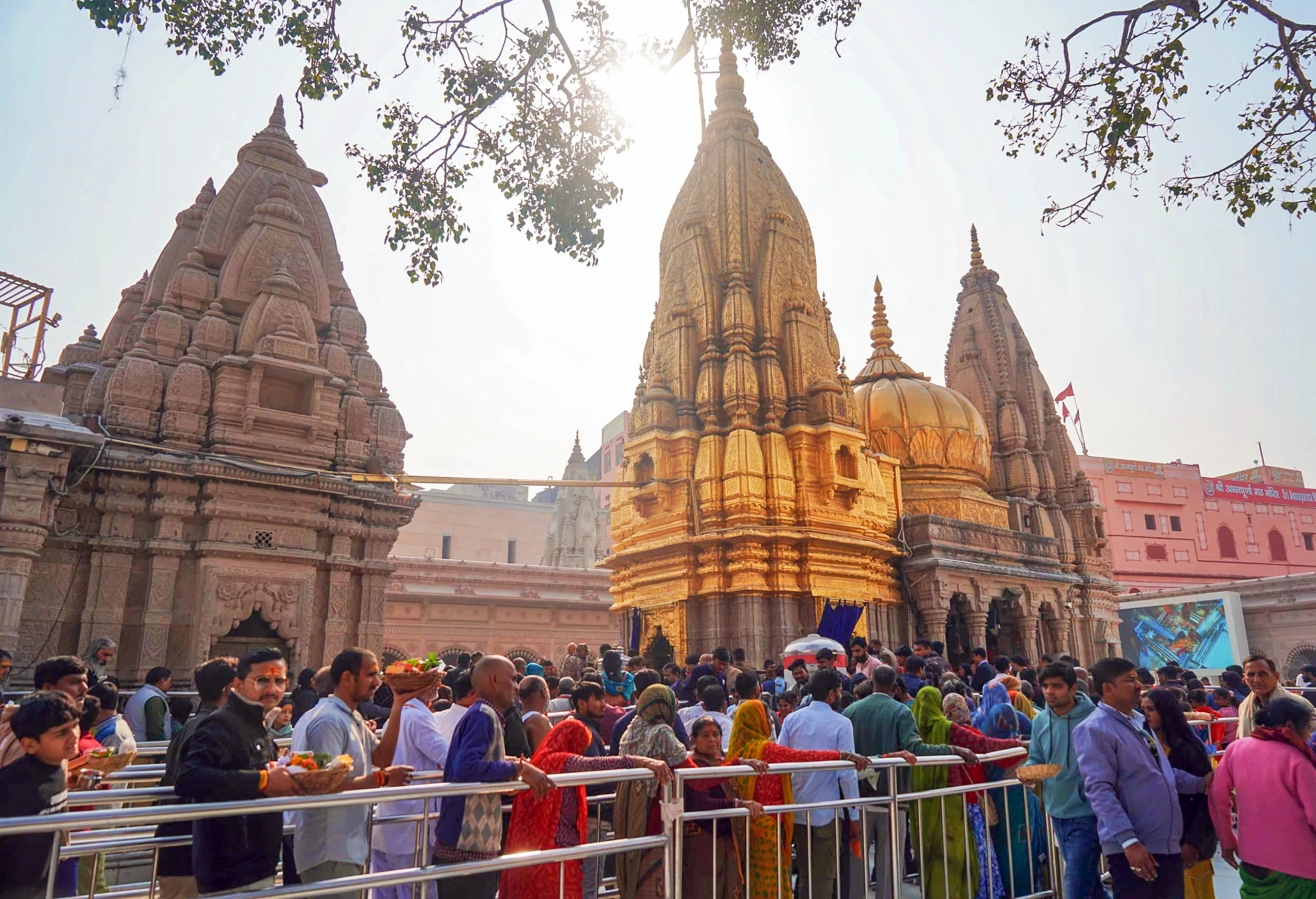
    Kashi Vishwanath, Varanasi

    Located in the old city of Varanasi, Kashi Vishwanath can be reached through Varanasi Junction or Lal Bahadur Shastri International Airport. From there, travellers can take a cab or auto to Godowlia Chowk. The final stretch to the temple involves a 10 to 15-minute walk through the security lanes.

    Somnath, Gujarat

    Somnath Temple at Prabhas Patan is regarded as the first and most ancient among the 12 Jyotirlingas. Veraval Railway Station, around 7 km away, is the nearest major rail point, while Diu Airport is approximately 65 km from the temple.

    Mahakaleshwar, Ujjain

    Mahakaleshwar stands on the banks of the Shipra River in Ujjain. The temple is about 2 km from Ujjain Junction, making the final journey possible by auto, taxi or on foot.

    Baidyanath, Deoghar

    Devotees heading to Baidyanath Jyotirlinga can use Deoghar Airport or Jasidih Junction. Pilgrims also undertake the traditional Kanwar Yatra from Sultanganj to reach the shrine.

    Kedarnath, Uttarakhand

    At an altitude of 3,580 metres, Kedarnath requires considerably more travel planning. The usual route involves reaching Sonprayag from Haridwar or Rishikesh, taking a shuttle to Gaurikund and completing the 16 to 18 km trek to the temple.

    Other Jyotirlingas To Visit

    Mallikarjuna in Srisailam, Andhra Pradesh, is known as the ‘Kailash of the South’. Hyderabad, Markapur Road and road routes through the hills are among the options for reaching it.
    For Trimbakeshwar in Nashik, travellers can use Nashik Road Railway Station, Ozar Airport or road routes via NH 160.

    Omkareshwar in Madhya Pradesh is located on Mandhata Island in the Narmada, with Indore and Khandwa serving as key travel hubs.
    Bhimashankar can be accessed from Pune or Mumbai, although monsoon conditions may make the Sahyadri routes slower. For Nageshwar, travellers generally reach Dwarka first and continue by local transport.

    ALSO READ| Why is Shiva worshipped as a Lingam while other gods have idols?

    Then in Tamil Nadu, Ramanathaswamy Temple in Rameswaram can be reached through Madurai Airport, Rameswaram Railway Station or by road across Pamban Bridge.
    Finally, Grishneshwar Jyotirlinga near Ellora can be accessed through Aurangabad by air, rail or road. During Sawan, the temple witnesses extended darshan hours and heavy crowds.

  • Did you know there’s a secret trail between Kedarnath and Badrinath? Discover the lost Himalayan path of the gods

    Did you know there’s a secret trail between Kedarnath and Badrinath? Discover the lost Himalayan path of the gods

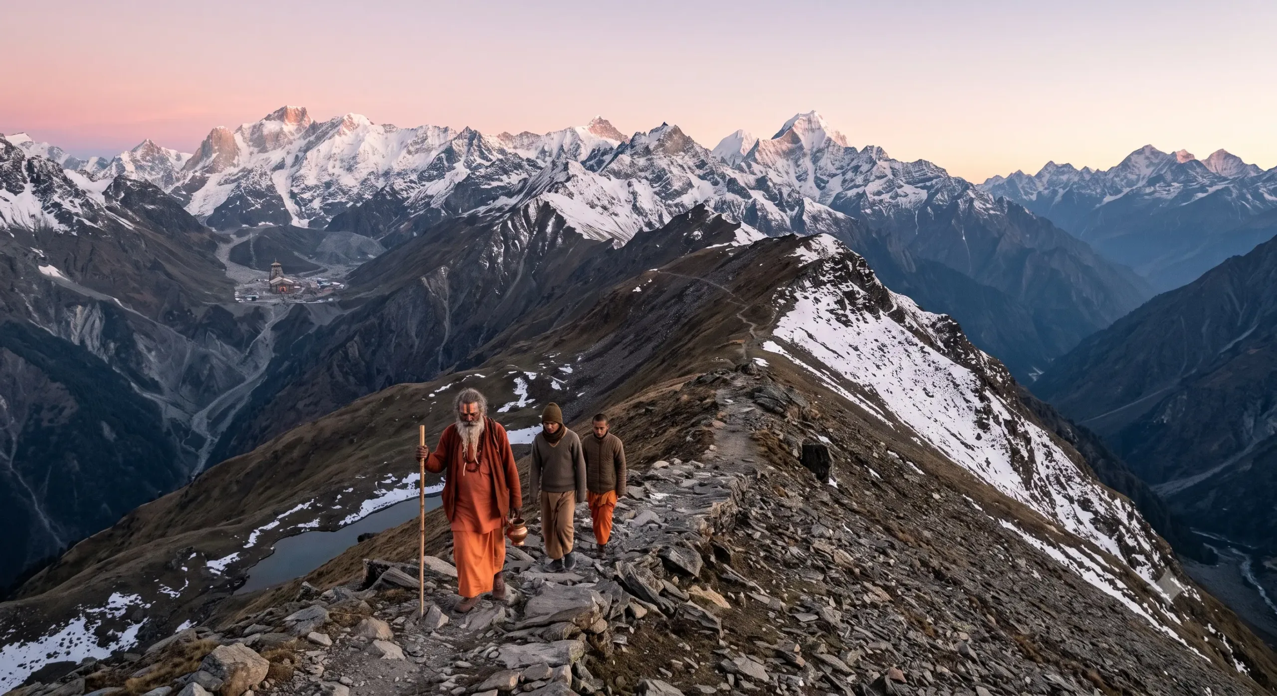
    There is one story that still intrigues devotees and trekkers of the Garhwal Himalayas: Dev Marg, the lost trail between Kedarnath and Badrinath. The journey between the two revered shrines is now a long road ride through the winding mountain roads, dipping down deep in the river valleys before returning to the high Himalayan mountains, taking up to several hours for the almost 200 kilometres of distance.

    But, but local folklore tells a very different story.

    Well before the advent of roads, helicopters and organised pilgrimages, there is a story of saints and wandering ascetics and the Himalayan shepherds following a path through an ancient mountain track that connected the two temples virtually. The path is known as the Dev Marg, the Path of the Gods, in Garhwali tradition, where it was believed pilgrims would pass over high ridges of the Himalayas and reach Lord Vishnu’s shrine at Badrinath and Lord Shiva’s at Kedarnath without being forced to go down to the populated valleys below.

    ALSO READ| Why is Shiva worshipped as a Lingam while other gods have idols?

    Whether this mysterious trail was once a functioning pilgrimage route or has since become part history and part legend remains a matter of debate, though. Yet even today, stories of the hidden path continue to echo through the mountains.

    This is not one of the miracle-based legends that often starts with a miracle and progresses from there, but rather one that started with geography. The Garhwal Himalayas are a huge catchment of glacial valleys backed by high ridges and concealed passes and snowfields that are untraveled for most of the year. Today’s trekkers are aware of many ancient shepherd paths that have traversed these mountains, long before this area was reached by roads. Many of these trails have been buried under ice, and some are only partially preserved.

    It is in this topography that the secret route of Kedar-Badri came into being. The locals think that Lord Shiva, after giving Lord Vishnu Badarikashrama as his seat of meditation, moved west and became Lord Kedarnath at Lord Vishnu’s place of meditation. 

    How the Puranas Inspired the Legend of the Hidden Kedar–Badri Route

    However, the break-up was never perceived as a partition. The Puranas repeatedly remind us that Shiva and Vishnu are two manifestations of the same Supreme Reality. The two sanctums are, therefore, said to have been spiritually united by an invisible Himalayan corridor which was traversed by the sages who were engaged in tapasya and not by ordinary pilgrims. 

    Old Garhwali ascetics describe the route not as a single well-defined trail but as a sequence of glaciers, alpine meadows and high passes stretching across some of the most isolated terrain in the central Himalayas. Beginning beyond Kedarnath, the path is believed to pass through regions associated with Vasuki Tal, climb towards remote snowfields and eventually descend through glacial basins leading into the upper Alaknanda valley near Badrinath. 

    Notably, Modern mountaineering expeditions have identified difficult alpine crossings in this broader region, but there is no recognised pilgrimage trail linking the two temples directly. The legend therefore survives primarily as folklore. 

    What makes this forgotten path particularly fascinating is the role it plays in the spiritual imagination of the Himalayas. Ancient ascetics were rarely interested in the easiest route. Their journeys themselves formed part of their discipline. To cross glaciers, endure freezing winds and walk for days without encountering another human being was not considered hardship alone; it was a means of quieting the restless mind. The hidden route from Kedarnath to Badrinath therefore came to symbolise the inward path travelled by those who had already transcended the ordinary concerns of worldly life. 

    Several wandering monks have claimed over the centuries that certain Himalayan sadhus continued to use sections of this route during favourable weather, though such accounts remain impossible to verify. These narratives often describe isolated caves where unnamed yogis spent years in meditation, surviving on glacial water, wild herbs and offerings occasionally brought by shepherds. 

    Whether every account is historically accurate is less important than what they reveal about the Himalayan tradition itself. The mountains have always been imagined as preserving a spiritual world largely hidden from ordinary sight, a realm where renunciation continues quietly beyond the reach of history. 

    What do these two ‘Nath’ symbolise?

    Kedarnath represents vairagya, the path of renunciation embodied by Shiva. Badrinath represents dhyana, the path of contemplative preservation embodied by Narayana. To walk from Kedarnath to Badrinath is therefore to move from renunciation towards inner balance, from the fierce austerity of Mahadeva to the serene meditation of Vishnu. The physical trail becomes a metaphor for the evolution of consciousness itself. 

    Then this deeper meaning is reflected in the annual pilgrimage traditions of the Himalayas. Even though devotees travel by road today, many still consider it spiritually appropriate to visit 

    Kedarnath before Badrinath. Local priests often explain that one first seeks the blessings of Shiva, who removes ignorance and ego, before approaching Narayana, who grants wisdom and inner peace. 

    Modern satellite imagery, trekking surveys and geological studies reveal that the region between Kedarnath and Badrinath is among the most rugged anywhere in the Himalayas. 

    Massive glaciers, unstable moraines, avalanche-prone slopes and rapidly changing weather make direct travel extraordinarily hazardous. These findings help explain why no continuous pilgrimage route survives today. It is entirely possible that ancient shepherd tracks once crossed parts of this landscape before glacial movement, earthquakes and landslides gradually erased them. The Himalayas are geologically young mountains, constantly reshaping themselves through tectonic activity and erosion. Trails that existed a thousand years ago may no longer exist in recognisable form. 

    This meeting of geology and mythology is characteristic of the Himalayas. Science explains how landscapes evolve through natural processes; tradition preserves the meanings people discovered within those landscapes. The legend of the secret Kedar–Badri route may therefore contain memories of genuine high-altitude crossings transformed over centuries into sacred narrative. 

    The real path between Kedarnath and Badrinath lies within the seeker.